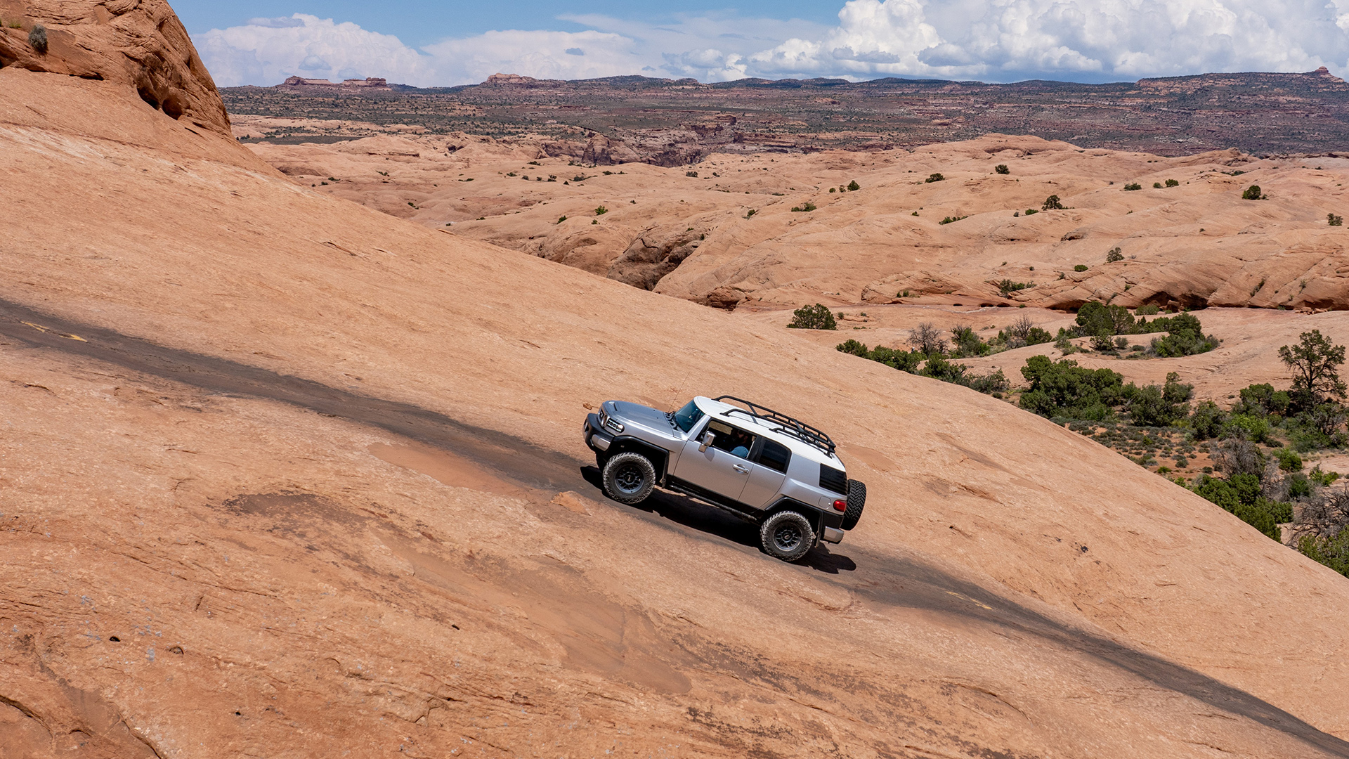
The Bureau of Land Management has approved a plan to close hundreds of miles of off-road driving trails outside Moab, Utah, capping a yearslong fight between environmental groups, off-roaders, and the federal government over trail access in the region. The new plan will shutter 317 miles of OHV routes across the spectacular Labyrinth Canyon and Gemini Bridges area just west of Moab, including a handful used during the annual Easter Jeep Safari event, to protect the sensitive desert landscape. With the closures scheduled to take effect this Saturday, October 28, the off-road community is in an uproar and gearing up for a protracted legal battle to keep the trails open as long as possible.
The BLM’s decision, announced at the end of September after a long and contentious public comment period, stems from a 2008 lawsuit filed by the Southern Utah Wilderness Alliance against the BLM for improperly managing public access to federal lands in Utah. As part of a 2017 settlement, the BLM has to revise and enforce new travel plans for 11 areas with an eye on protecting wildlife habitats, sensitive ecosystems, and cultural resources. But few places hold the significance Moab does for off-roaders, who claim the new Labyrinth/Gemini plan is overly restrictive and could have huge economic consequences in an region that depends on tourism.


“The new plan provides predictability and clarity for users, minimizes user conflicts and damage to natural and cultural resources, meets access needs, increases public safety, and addresses law enforcement issues within the area,” reads a BLM press release.
Currently, there are 1,057 miles of drivable “off-highway” routes—everything from dirt roads to rough two-tracks to extreme rock-crawling trails—across the 300,000-acre area, and another 71 miles open to smaller motorized vehicles. The BLM plan, which is a blend of a number of scenarios it publicly considered, would shift that balance dramatically.
In addition to closing 317 miles of roads and trails to all motor vehicles, it would also block trucks from another 18 miles, leaving just 712 miles of OHV routes remaining. That’s a full third gone, everything highlighted in red on the map below.

Among the better-known trails slated for closure are Hey Joe Canyon and Day Canyon Point, both of which are Easter Jeep Safari spots; Ten Mile Canyon, a popular side-by-side trail; Mineral Bottom Road, which leads to a series of beautiful dispersed campsites at the edge of Canyonlands National Park; and a number of lookouts over the Green River along Labyrinth Canyon. The BLM points out the plan still keeps over 90% of Easter Jeep trails open, but many off-road advocacy groups see it as a disaster that will start pushing them out of Moab entirely.
“There’s no other way to say this. This travel plan is the worst defeat motorized recreation has suffered in decades. SUWA won. Moab is lost. Almost every major trail west of Moab is closed,” Patrick McKay of Colorado Off-Road Trail Defenders wrote on Facebook. The Blue Ribbon Coalition, a national group dedicated to preserving trail access, called it “the worst plan possible for public access to the area” in a lengthy blog post laying out its own plan to fight back with legal challenges, aggressive lobbying, and community involvement. It also points out that its not just off-roaders who will suffer, as a number of campsites, mountain bike trails, and access roads to hiking trailheads will be closed.
“There was a decent amount of route density in the Labyrinth Rims and Gemini Bridges area to where there was a good balance of all recreation uses,” Blue Ribbon Coalition President Ben Burr told The Salt Lake Tribune. “Now, they’ve tilted in favor of hurting a lot of recreation users.”
Environmental groups including the Southern Utah Wilderness Alliance say the plan is necessary to protect the delicate ecosystem, especially the sensitive riparian zones along the Green River, which have deteriorated as off-road recreation increased in the last decade. The new map will close nearly half of all legal water crossings in the area and significantly reduce the number of trails that get within 100 yards of a stream or river. “This is an opportunity for the BLM to finally get it right, to balance management and to actually protect the river corridor and those side canyons,” SUWA attorney Laura Peterson said to Deseret News. Right now, another activist told the paper, it’s basically a “free-for-all.”
The BLM released its decision on September 28, starting a 30-day countdown for the closures to legally take effect after this Saturday. It’s unclear how and when the BLM might start enforcement, though unless the planned legal challenges produces a stay, you can expect access to start being restricted with physical barricades or other means before long.
This is only the third of 11 areas whose general access and off-road vehicle use will be reworked by the BLM as part of the 2017 settlement. Still left to modify include the Henry Mountains Travel Management Area, Trail Canyon, San Rafael Swell, and more. The regions in question make up more than 6 million acres of BLM-managed land across southern and eastern Utah.
Got a tip? Send us a note: tips@thedrive.com