We’ve reported on DARPA’s stunning innovations in technology for quite some time. From its revolutionary fixed-wing, vertical takeoff and landing (VTOL) naval drone and its modular laser-centric anti-drone gun, to funding a disintegrating UAV for single-serving deliveries in remote locations, the government’s defense agency has overseen some truly incredible projects.
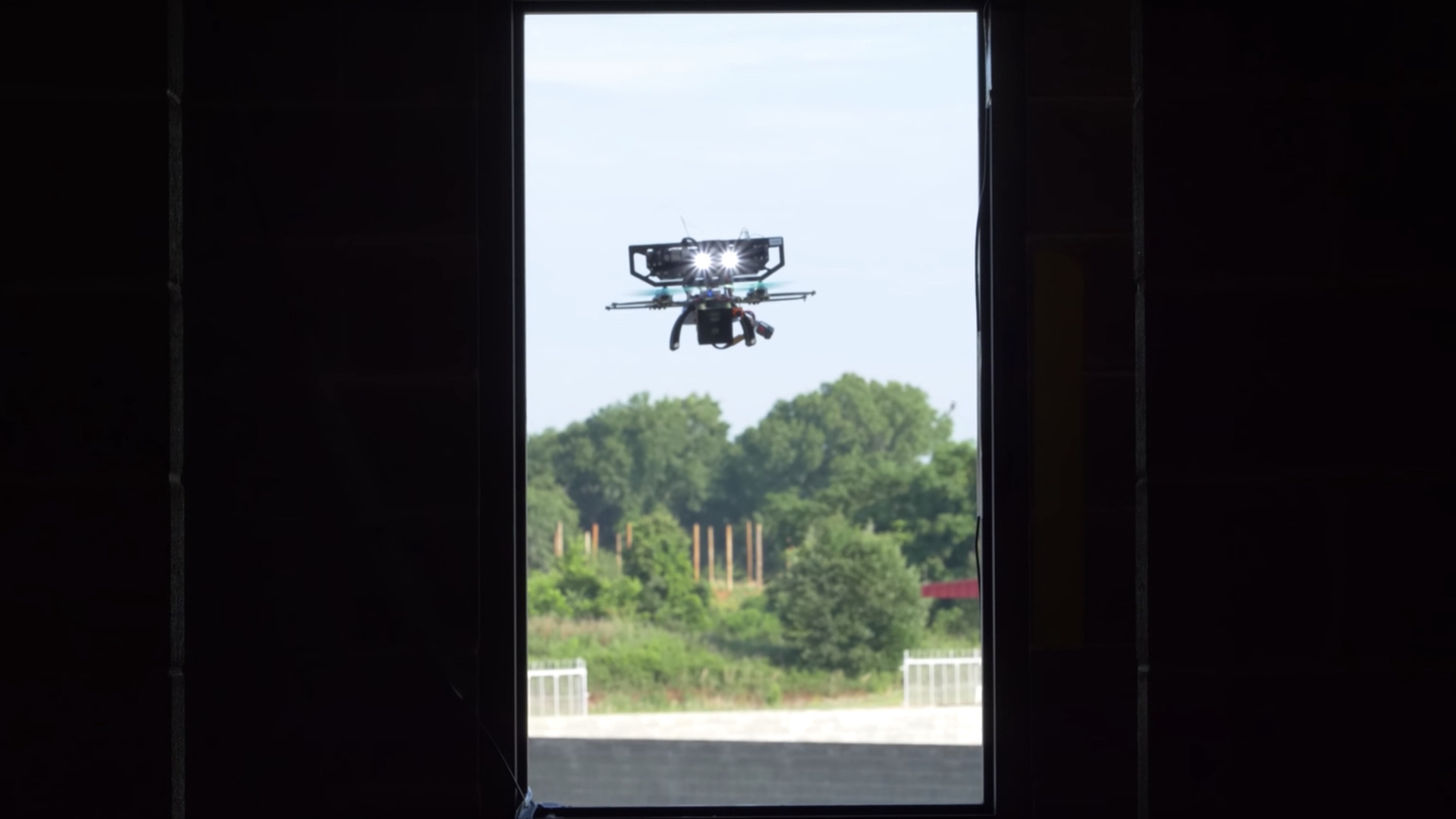
Most recently, DARPA’s Fast Lightweight Autonomy (FLA) program completed Phase 2, which saw advanced algorithms turn a drone into an autonomous reconnaissance aid, according to a press release from the agency. The results saw a small UAV navigate narrow interiors in simulated urban environments, infiltrate multi-story buildings, create 3D maps of their interior, identify objects, descend stairways, and find open exits.
DARPA’s researchers learned a lot from Phase 2 test flights in 2017, primarily that reducing the drone’s weight while modifying onboard sensors for more accurate performance would be the only way to achieve effective, autonomous navigation of the above-mentioned environments. To help them do so, engineers from MIT’s Draper Laboratory and the University of Pennsylvania lent a hand.
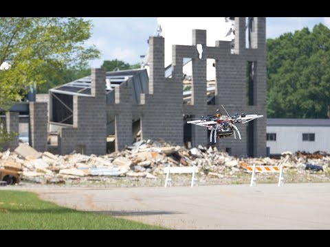
“This is the lightweight autonomy program, so we’re trying to make the sensor payload as light as possible,” said Nick Roy, co-leader of the MIT Draper Laboratory team. “In Phase 1 we had a variety of different sensors on the platform to tell us about the environment. In Phase 2 we really doubled down trying to do as much as possible with a single camera.” The Phase 2 flights took place in a mock town in Perry, Georgia, which was comprised of partially destroyed buildings, roads and rubble.
During the demo, DARPA’s FLA drone flew between multi-story buildings at rapid speeds, navigated narrow alleyways and windows, entered buildings, traveled down hallways, identified objects, descended staircases, exited through open doorways, and created 3D maps of everything it encountered. Frankly, the results are unbelievably impressive and terrifyingly ominous in equal measure.
Fast Lightweight Autonomy (FLA) Phase 2 Flight Testing
The 3D mapping is not only helpful for those back at command who, in a search and rescue mission or military operation might want to know the geography of the building being aerially infiltrated, but for the drone itself, as well. “As the vehicle uses its sensors to quickly explore and navigate obstacles in unknown environments, it is continually creating a map as it explores and remembers any place it has already been so it can return to the starting point by itself,” explained Jon How, the other MIT Draper team co-leader.
Currently, the three-year-old FLA program’s main focus has been on aerial missions only, but DARPA Program Manager J.C. Ledé is confident the technological advancements could effectively pivot to autonomous ground-based vehicles as well.
“The outstanding university and industry research teams working on FLA honed algorithms that in the not too distant future could transform lightweight, commercial-off-the-shelf air or ground vehicles into capable operational systems requiring no human input once you’ve provided a general heading, distance to travel, and specific items to search,” explained Ledé. “Unmanned systems equipped with FLA algorithms need no remote pilot, no GPS guidance, no communications link, and no pre-programmed map of the area—the onboard software, lightweight processor, and low-cost sensors do all the work autonomously in real-time.”
If these advancements aren’t mind-boggling enough, Camillo J. Taylor of the University of Pennsylvania team said palm-sized smart UAVs are next. These would contain even more processing power than Phase 2’s FLA drones and would be portable enough for any search and rescue member or soldier to easily transport on their person. As it stands, we’re either extremely lucky not to see such advanced and efficient military theater operations, or terribly unfortunate not to have these cutting-edge tools for search and rescue missions at our disposal. One thing is certain: we’re living in the most technologically impressive era in recorded history.