In a recent open letter to shareholders, Google co-founder and CEO Larry Page enthusiastically reminded investors that Alphabet’s drone delivery program, Project Wing, is advancing admirably. Project Wing co-leader James Ryan Burgess went into a little more detail in a Medium post he shared on Wednesday. Essentially, the drone program has begun testing their new management software, a task which involves NASA, the FAA, and drone technology from Intel and DJI. The main focus is regulating and maintaining secure flight paths, as more drones will share the same airspace together as time goes on. This is the sort of thing Google is good at: awareness of problems before they exist.
In order to most effectively reach that goal, the Research and Development department of Project Wing has been working on a drone of their own, as well as developing the software to manage these Unmanned Airtraffic Systems (UAS). The goal is to create a UTM —UAS Air Traffic Management—to avoid collisions, regulate flight paths, and ensure as much safety as possible.
According to Burgess, “Within a few years, Wing and other companies are likely to have fleets with thousands of UAS in the air at any one time, so we’ll need systems that can dynamically route UAS not only around each other, but around manned aircraft, buildings, terrain, weather patterns and special events.”
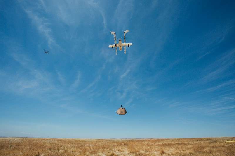
Take a look below at the UTM passing the recent test in California with flying colors, as it avoids another drone while completing a delivery.

The systems being developed by Project Wing require more detail and nuance than regular flight path coordination, as a crucial aspect of future and current drone deliveries is the ability to navigate in close quarters and low to the ground, amidst buildings and other obstacles. This is where the integration of mapping data from Google Maps comes in.
According to Burgess, “Google Maps, Earth, and Street View have helped us create a detailed understanding of the world—including the buildings, roads, trees, and other terrain—that UAS need to navigate safely. In addition, Google’s cloud computing infrastructure will enable our UTM to support millions of routes, process decisions in fractions of a second, and deliver the reliability that’s critical for managing aircraft.”
The test flights that took place yesterday went smoothly, with Burgess seemingly confident at Project Wing’s progress and their current version of the UTM they’ve been working on. In his post, Burgess states that the Wing team “showed that our traffic management platform can manage the complex flight paths of multiple UAS at the same time. This is an important step that paves the way to a future where many UAS operators can fly safely together. It also makes it possible for a single operator—a person or organization—to fly multiple aircraft simultaneously.”
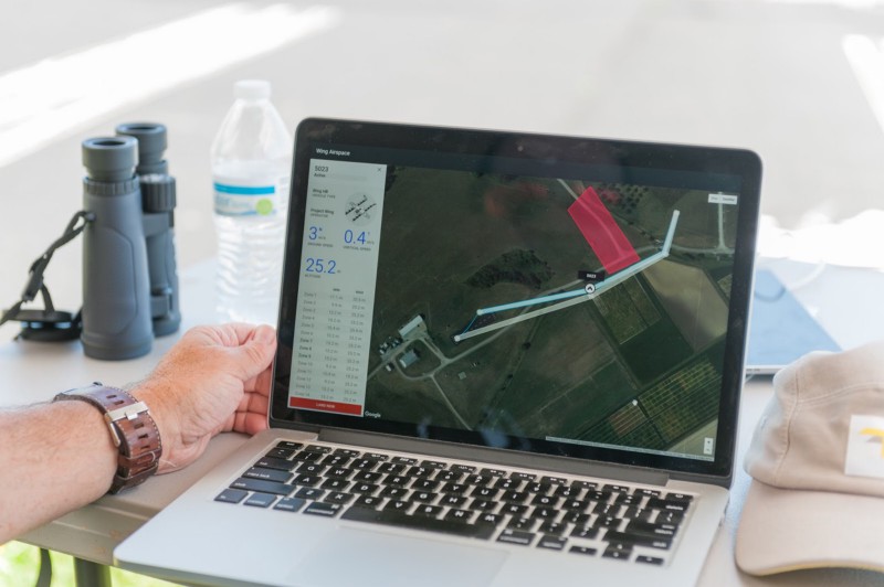
The three drones they used were built in-house and piloted by a single operator amidst two drones from Intel and DJI, in order to test the UTM’s ability to avoid air-traffic, to successful results. Here’s a photo of the Project Wing team processing real-time analytics from the drones in the air.
The primary focus of Project Wing in advancing the UTM they’ve developed is comprised of three key goals, which Burgess shared in his post. Firstly, to share “real-time route planning for UAS that are flying in the same area,” to provide “notifications to alert operators of any unexpected changes in the aircraft or route during flight,” and finally, to provide “airspace notifications that allow operators to avoid FAA no-fly zones and safety-sensitive areas (for example: forest fires).”
This seems like a logical approach and a fairly simple place to start, but the team at Project Wing still has a long road ahead of them. As Burgess puts it, “Yesterday’s tests showed that an important foundational technology is making good progress, and we look forward to updating you on additional tests in the coming months.”