The last time we reported on the nexus between drone technology and the nuclear disaster in Fukushima in 2011, it was focused on the Japanese city of Odaka using unmanned aerial vehicles to bring some semblance of peace to the town by bringing drone delivery to the area. More recently, however, we’re seeing drones being implemented into the actual scene of the disaster, as a U.K.-developed quadcopter that can map radiation will soon be deployed to the reactor in Fukushima.
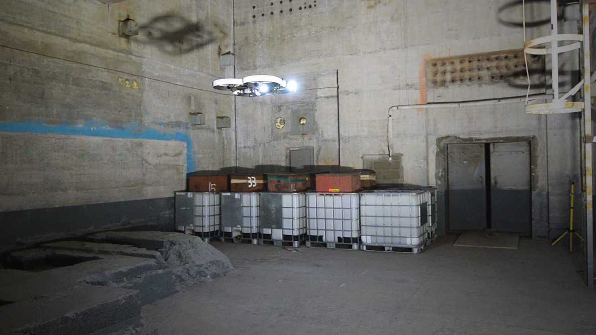
According to The Engineer, the Remote Intelligence Survey Equipment for Radiation (RISER) drone was a joint venture in its production, as it uses both software from Createc and drone hardware by Blue Bear. The former—Createc’s N-Visage radiation mapping software—is what will allow scientists to create 3D maps of the contaminated area. Blue Bear’s UAV, meanwhile, is capable of using lasers to autonomously navigate the radiated facility—an area where reliance on GPS is futile. This project was funded in part by the Nuclear Decommissioning Authority (NDA) and Innovate U.K.
“We are thrilled to see RISER put to work in Japan, and delighted that our early-stage support for the N-Visage system enabled Createc to develop its potential further,” said Professor Melanie Brownridge, who heads NDA’s technology division. “The subsequent collaboration with Blue Bear, again funded by the NDA through an initiative with Innovate UK, led to RISER. This shows the importance of funding innovative ideas through their journey from the drawing board to the market – not just for the NDA’s decommissioning mission but for the wider UK and overseas economy.”

It’s important to note that the RISER radiation-mapping technology has reportedly already been implemented at the reactor site in Fukushima, but that this new initiative is allowing for hitherto unexplored areas to be analyzed, thanks to Blue Bear’s UAV. The drone in question has a diameter of less than three feet and is fitted with a highly necessary obstacle avoidance system. The RISER system was used at the Windscale Pile nuclear power plant site in Sellafield, England, which became too hazardous to enter after the fire in 1957.
When it comes to monitoring areas too dangerous to observe in person, modern drone technology seems like the most logical, affordable, and practical way to go. These aerial tools of ours, which can be equipped with high-tech sensors for a wide range of purposes, can keep people out of harm’s way while simultaneously analyzing how volatile sites like Fukushima currently are.