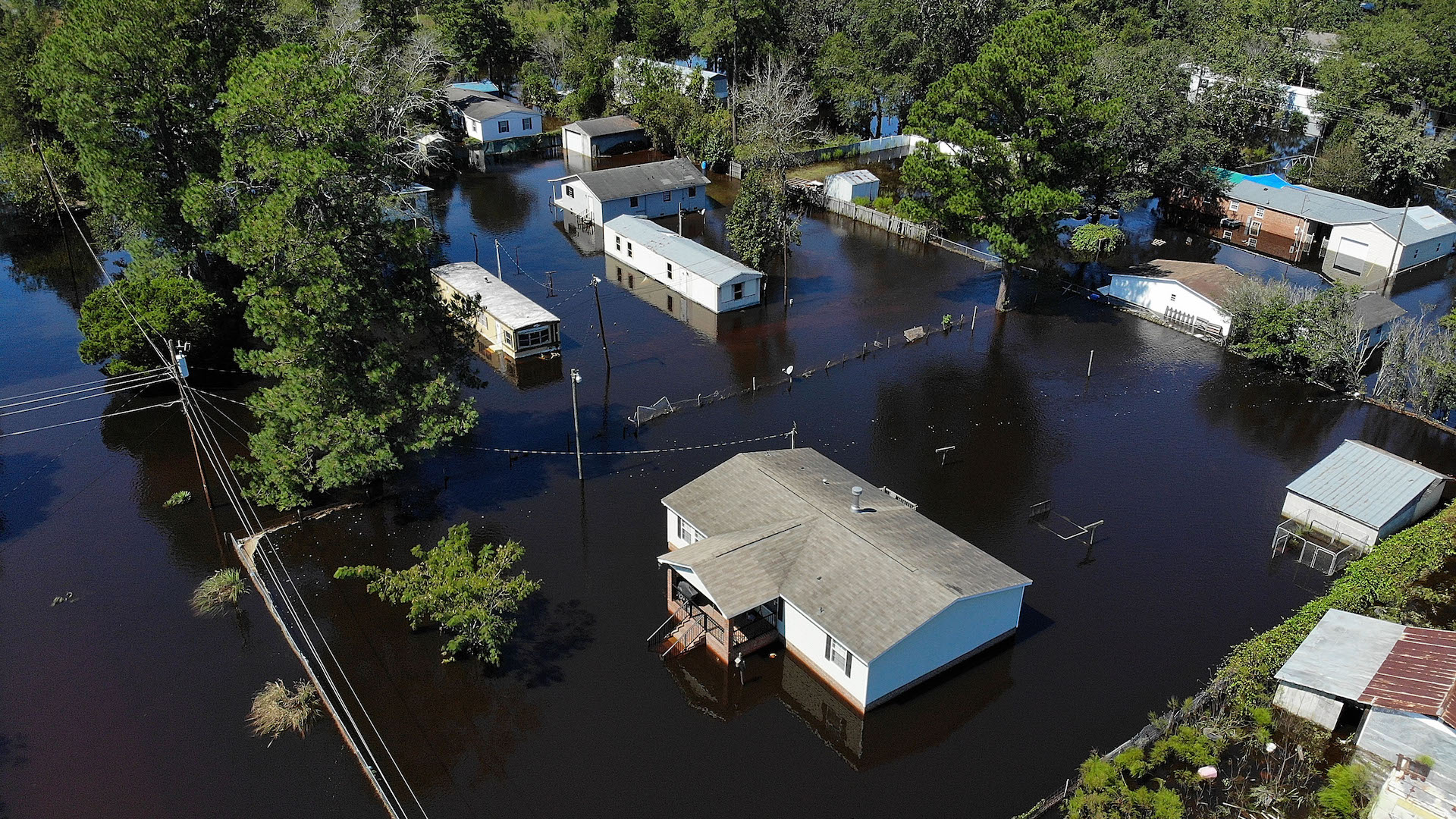
The world’s largest drone operations company, DroneBase, just formed a partnership with Geomni, an analytics company, by allowing the latter to utilize the former’s unprecedented commercial drone pilot network for global property inspections. As time advances and superstorms continue to strike, assessing damage and insurance estimates rapidly is garnering more demand, thus the reasoning behind this techy co-op.
DroneBase has completed over 100,000 commercial drone missions in 70 countries and all 50 domestic states. Geomni will garner access to DroneBase’s network of drone pilots, as well as its API, while DroneBase will be able to use Geomni’s fleet of fixed-wing drones to ramp up inspections across the world. In all, this is certainly a mutually beneficial partnership.
“The insurance industry is beginning to tap into the power of drones, and aligning with Geomni should demonstrate the ROI-positive impact of drones can have for insurers,” said DroneBase founder and CEO Dan Burton. “Through the scale of DroneBase’s Pilot Network and API, our imagery will help speed insurance claims and more.”
To Burton’s point regarding the insurance industry, we have indeed seen quite the change in recent months from a seeming hesitance to employ drones to an eager desire to standardize them. Most recently, State Farm garnered FAA approval to use drones to more rapidly assess damage by Hurricane Florence across four states. In Europe, meanwhile, it’s the utility companies that are opting for this unmanned aerial alternative to its conventional counterpart. All over, businesses keen on minimizing cost and increasing efficiency are noticing that UAVs are an effective tool.
For Geomni’s customers, this partnership will result in the following practical process. First, a customer places an order for a data package of a roof or property, which will then alert DroneBase’s API and assign the nearest drone pilot to deploy a UAV and capture the aerial imagery. This high-resolution imaging is then converted in as little as 48 hours into useable, insurance-centric data. Xactimate, an insurance industry-leading software platform, for instance, will be fully compatible with the collected data.
“DroneBase has demonstrated their excellence in capturing aerial UAV imagery and, paired with our current fleet of manned aircraft, is expected to add more options for insurers and other industries around the globe,” explained Geomni’s president, Jeffrey C. Taylor. “This is an important time in insurance with hurricane season underway.”
The nexus of unmanned technologies and hurricanes has grown profoundly from last year’s storm season to the one currently in progress. Not only have DroneBase and Geomni themselves already helped in post-disaster efforts last year, but we’re seeing remotely operated underwater drones assess the more nuanced impact of these storms, as well, in addition to the aforementioned State Farm endeavor. Drones as a solution for insurance, inspection, and disaster relief are simply growing in popularity with every passing year.