Since its launch in 2005, Google Maps has become an invaluable tool for navigating around the world. Over time, innovations have been added to improve the service, like Street View’s on-the-ground photography and integrations with local transit systems. Now, Google has announced a super intriguing upgrade in the form of the new Immersive View mode.
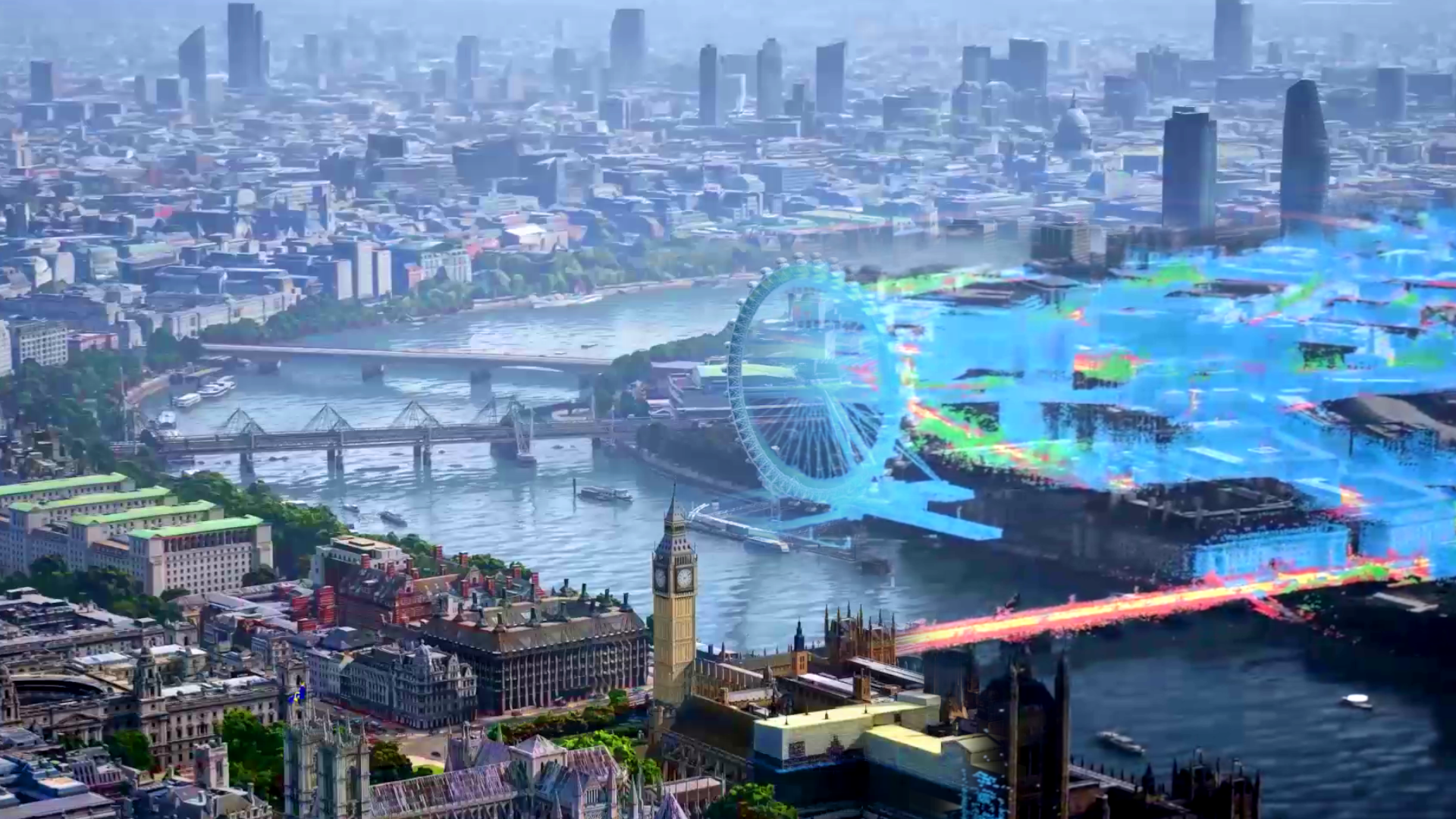
Immersive View is a feature that aims to add rich information to Google Maps well beyond simple navigational hints. Google has taken its treasure trove of Street View images, along with its aerial photos, and created an advanced digital model of various cities that users can now explore virtually. It was all put together with the aid of computer vision and AI techniques.
Thus, in cities where Immersive View has been enabled, there’s no need to squint at blurry Street View images when you’re trying to figure out the vibe of an area. Instead, there’s a 3D world available to explore from any angle. It’s much easier to get a feel for the layout of a place when you can freely change perspective and see how everything is related in a spatial manner.
Impressively, this new mode even lets users explore how a place changes throughout the day or in different weather conditions. Not only can you find yourself a great cafe to eat lunch at, but you can then figure out where the best table is to catch the noonday sun. In some cases, Immersive View even simulates some building interiors so you can peek inside before you go.

The system is paired with the data overlays that make Google Maps so useful. Icons pop up to highlight restaurants, landmarks, or points of interest, a feature of particular appeal to those visiting an area for the first time.
Naturally, creating a realistic 3D world that replicates a real city is no mean feat, and Google isn’t rolling this feature out worldwide all at once. Immersive View will be available for London, Los Angeles, New York, San Francisco, and Tokyo later this year, and more cities will then be added in due course.
Google has also announced updates to its Live View feature, too. It lets users point their phone camera around a public space, with Google’s software overlaying icons and pointers via augmented reality. It’s much easier to get around when you can see directions directly overlaid on the street in front of you, after all. Google is now eager to share this technology with other developers, with the ARCore Geospatial API letting coders whip up new augmented reality experiences using Google’s global localization technology.
Finally, the latest Maps update comes with a new “eco-friendly” routing feature. Rather than optimizing for travel time, the eco-friendly pathing mode aims to choose the most fuel-efficient route, saving drivers money and reducing emissions, to boot. Since its recent launch in the U.S. and Canada, users have apparently driven 86 billion miles on eco-friendly routes. Google estimates this has saved half a million metric tons in carbon emissions and hopes to improve on this figure with a later rollout to Europe.

Google Maps is one of those things that reminds us that we’re living in the future. It’s an immense amount of data and functionality that we access with a tiny magic oblong that sits in the palm of one’s hand. With these latest updates, Google seems set to continue leveraging the platform to pull off even greater feats.
Got a tip? Let the author know: lewin@thedrive.com