A Company Has Created Drone-Based Infrastructure Inspection Services for Utility Companies
Sharper Shape Inc. wants to automate the electric utilities inspection field with their ‘Automatic Detail Inspection’ system.

Sharper Shape Inc. wants to bring its drone-based 'Automatic Detail Inspection' (ADI) service to major electric utilities companies in the United States. Having just successfully completed field trials, the company is now making its end-to-end drone-based inspection system readily available for commercial use. The company announced its ADI service and field trial completion this week, in hopes to allow the "drone software as a service" to increase the efficacy of electric utilities companies across the country.
How would this work, exactly? Well, the entire process of inspections of "critical infrastructures" would be automated. You'd no longer need people 'on the ground', which eliminates costs. Drones would cut down on a lot of time, further eliminating expenditures.
In addition to the obvious, Sharper Shape has a far more interesting trick up its sleeve. According to sUASnews, before a single inspection takes place, Sharper Shapes ADI Flight Planner software would construct extremely accurate 3D models of the infrastructure in question. After creating a digital map of all power lines, towers, and other critical infrastructure using the lidar (light detection and ranging) data recorded via drone, the Flight Planner software would arrange for the most optimal and efficient inspection routes possible. This would then allow unmanned aerial vehicles (UAVs) to do routine inspections, detect defects anywhere on their path, and communicate with the on-the-ground system or utility company faster than an employee could scale an electric pole.
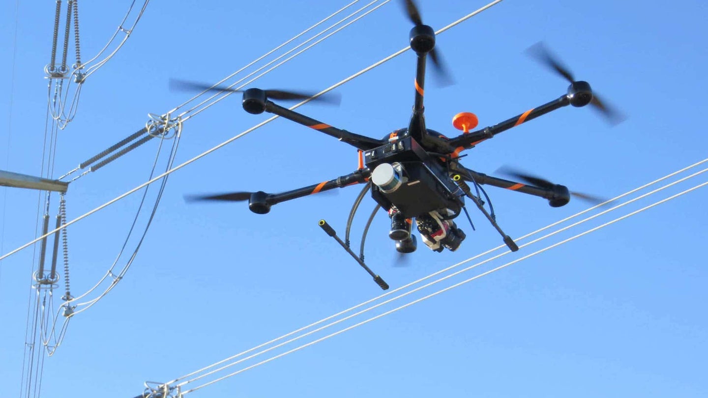
Let's have a look at one of the drones using Sharper Shape's ADI service:

It seems like a highly logical and effective idea: Drones follow along a 3D map of the critical infrastructure, notice defects on any wires, cables, poles, and any other vital components, take photographs or video footage of the damaged equipment, relay that information back to base, and have that data ready for employees to analyze, inspect, and repair.
"With our new ADI service, not only are we automating the drone field operations, but we are also providing a complete post-flight software environment for performing intelligent computer-assisted analysis of the massive amount of data captured during each flight," Ilkka Hiidenheimo, CEO of Sharper Shape, says. "There really is no reason our automatic flight operations and inspection software can’t be equally effective when working on cell phone towers, wind turbines, or many other critical industrial assets."
